


Arecibo Incoherent Scatter Radar Model
(a REU project at MIT Haystack Observatory carried out by Ashley Brooks in
summer 2004; see her REU final report and
her PointPoint
presentation .)
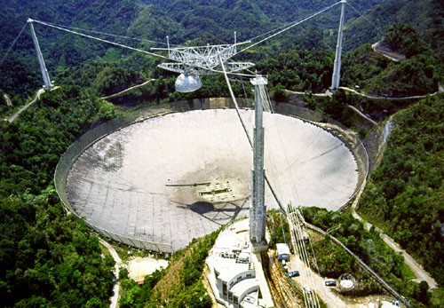
The Arecibo incoherent scatter
radar in Puerto Rico is located at 18.3N, 66.7W with an operating
frequency of 430 MHz. Data for Arecibo is archived in the CEDAR database
and imported into the MADRIGAL database for the years 1970 until 2002.
In the database parameters Ne, Ti, Te, and line-of-sight ion velocity are
available. Experimental data with CEDAR "kind of data" codes 2010, 30001,
30002, 30003, 30009, and 300015 are used in an attempt to secure a proper
amount of data for modeling.
The data is extracted for each month and stored into individual
directories for the next-step binning and fitting. Each month of data for
the seasonal bin contains three months worth of data.
The electron density, ion temperature, electron temperature, and
line-of-sight ion velocity variables are separated into local time hourly
bins, and the altitude variations are modeled using a piecewise linear
function at different altitude nodes. There are fifteen nodes. Each one
is determined according to the height points for one of the main
experiments modes (or "kind of data"), and they are 145, 182, 219, 256,
293, 330, 367, 405, 442, 479, 516, 553, 590, and 627 km.
(since Oct 21, 2004, these are
100, 110, 120, 130, 140, 160, 180, 200, 225, 250, 300, 350,
400, 450, 500, 550, and 600 km.)
The Arecibo
model uses a least-square-fit method to determine the altitude dependence,
as well as solar activity and magnetic activity dependences assuming
linear to F10.7 index for the previous day and ap index for the previous
three hours, as indicated below:
P = a0 + a1 × f + a2 × a (1)
P is one of the measured parameters (Nel, Ti, Te, or parallel ion
velocity), f ((F10.7-135) / 100) is the normalized F10.7 index, a0, a1,
and a2 are the fitting coefficients, and a ((ap - 15) / 10) is the
normalized ap index. This
bin-fit technique was used for the Millstone Hill, St Santin and
Shigaraki ISR models.
The model error is obtained by calculating the model and data difference
for each point of the data and finding the root of the mean of the squared
difference (r.m.s.).
Model Availability
The model can be provided to interested users with recovery FORTRAN codes
and coefficient data files. It is also available for online interactive
calculations and plots; the URL is
http://madrigal.haystack.mit.edu/models/ARisrm_form.html. Based
on
near realtime solar geophysical indices, a Virtual Arecibo Radar (VARR) is
created which predicts the ionospheric conditions for Ne, Te, Ti and
V// at current local time as well as for the whole
day at Arecibo. The VARR is at
http://madrigal.haystack.mit.edu/models/varr/.
Please contact Shunrong Zhang or John Holt for more details
about the model.
Acknowledgements
The
Arecibo Observatory is the principal facility of the National
Astronomy and Ionosphere Center, which is operated by the Cornell
University under a cooperative agreement with the National Science
Foundation.
Arecibo data have been obtained from the CEDAR Database, and
are maintained through the MADRIGAL
database system at MIT Haystack Observatory. Bill Rideout
maintains the madrigal database and provides software to process the
data.
This project is based upon work supported by the National Science Foundation under Grant
Number 0207748. REU student Ashley Brooks carried out this work. Her
advisors were Shunrong Zhang and John Holt.
The Millstone Hill
incoherent scatter radar is supported by a cooperative agreement
between the National Science Foundation
and the Massachusetts Institute of
Technology.